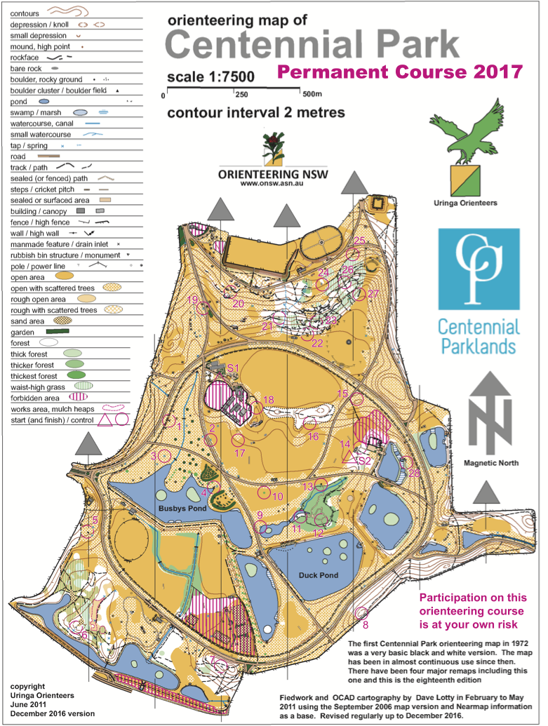
Did you know there’s a permanent orienteering course in the heart of Sydney’s Eastern Suburbs at Centennial Park? First mapped in 1972, it’s been revised 4 times over the year’s and is one of Australia’s finest permanent courses.
The course can serve as a fabulous introduction to orienteering, is easily reached from much of Sydney, and can be run at any time with just a map and compass if you wish. The course’s controls take the form of orange and white markers on posts with a number corresponding to the number of the control. Well-placed, they are not hidden but are not so obvious that you don’t have to do some serious navigating to find them.
The course itself is expansive, with lots of distance between controls to run and with nicely varied terrain – from forested slopes on the north side through fields in the centre to more low-lying ponds and swamps to the south. The wealth of distinctive landmarks makes navigation a lot easier for first-time orienteers.
One of the great things about this course is that, while it covers quite a lot of ground, it’s very hard/impossible to get lost on it, due to the easy geography, landmarks and roads. And hey, if you get tired, just drop in on one of the cafés for a cool drink to spritz yourself up again! A great introduction to orienteering in the centre of Sydney!
There are two possible Start+Finish markers located in the middle of the park, so if you’re coming by car, either park close to the northern café for S1 (Start/Finish 1) or on Dickens Drive or Loch Avenue for S2 (Start/Finish 2) and the course will lead you back to your car.
You will need a compass, running shoes and a map to complete the course. The map of the course was created by Uringa’s own Dave Lotty. You can download it out at the bottom of this page from the link just below and print it to take to Centennial Park.